
What are the best backcountry mountain bike trails in New Zealand from a professional mountain bike guide and founder of Adventurefuel Bike Guiding. This list is based on over 5 years mountain bike guiding in New Zealand and over 15 years riding here myself.
The best backcountry mountain bike trails in New Zealand (in no particular order)
- The Old Ghost Road
- The Paparoa
- The Heaphy
- The Craigieburns
- The St James
- The Coronet Loop
- The Timber Trail
| Name/ Area | Region | Distance | Days to ride | Difficulty | Do we guide it? |
| The Old Ghost Road | The West Coast, South Island | 85km (53 miles) | 2-3 | Grade 4 or 5 (Single Black) | Yes, on our 7 Day Tour and E-MTB Tour |
| The Paparoa | The West Coast, South Island | 56km (35 miles) | 1-2 | Grade 3-4 (Blue or Single Black) | Yes, Can be added to custom trips |
| The Heaphy | The West Coast, South Island | 78.4 km (48.7 miles) | 2-3 | Grade 4 (Single Black) | No |
| The Craigieburns Network | Canterbury, South Island | 111 km (69 miles) | 1 | Grade 3-5(Blue to Double Black) | Yes, on our 7 Day Tour and E-MTB Tour |
| The St James | Canterbury, South Island | 59km(37 miles) | 1-2 | Grade 3-4 (Blue or Single Black) | Yes, coming soon on our new itineraries or can be added to a custom trip. |
| The Coronet Loop | Otago, South Island | 50 km (31 miles) | 1 | Grade 3-4 (Blue or Single Black) | No |
| The Timber Trail | Central North Island | 85 km (52 miles) | 2 | Grade 3(Blue) | No |
What Rider is this list for?
These trails are for intermediate to advanced mountain bikers who like to earn their descent. Big days of world class riding in the backcountry that New Zealand is famous for. Based on the IMBA Epic description;
“what many mountain bikers live for and make travel plans around: immersive rides that are technically and physically challenging, beautiful to behold and worthy of celebration.”
Think deep forest. alpine ridges and winding singletrack, no crowds and epic views.
The Old Ghost Road
Where: Starting in Lyell and finishing in Seddonville on the West Coast (can be ridden in either direction but more descent going East to West)
What kind of riding: 85km (53 miles) of purpose built mountain bike trail winding through native forest and then across the multiple alpine ridges above the rainforest.
Highlights: This is rated one of the best MTB tracks in the world and undoubtedly one of the best backcountry mountain bike trails in New Zealand. Stay at the alpine huts with running water, wood fires and views you wouldn’t believe. Waking up to a sunrise and then an 800m (2,640ft) descent is next level.
How hard is it? There are big riding days (2500m/ 8,250ft of elevation gain over the whole track) and you would need to carry in food, sleeping bags and be self sufficient for medical and mechanical emergencies.
How technical is it? Grade 4-5 (Single Black) trails that have big drop offs and exposure. The trail is mostly well maintained with a few rock sections but no drops or jumps. The Grade 5 comes from the exposure and remoteness of the trail.
Things to know: Huts book out fast for the prime summer months December to March. There is little to no cell reception for most of the trail so you need to be able to fix mechanical issues and we suggest renting a Personal Locator Beacon.
Do we guide it? Yes, it is part of our 7 Day Backcountry Mountain Bike Tour and we ride the highlights on our 7 Day Backcountry E-MTB Tour. This is one of the best trails in the world and we wouldn’t want to miss it! Yes, it can be self-guided by strong riders/ bikepackers who are confident in very remote terrain and technical riding. You would also need to arrange a vehicle transfer to get your car brought around to Seddonville.
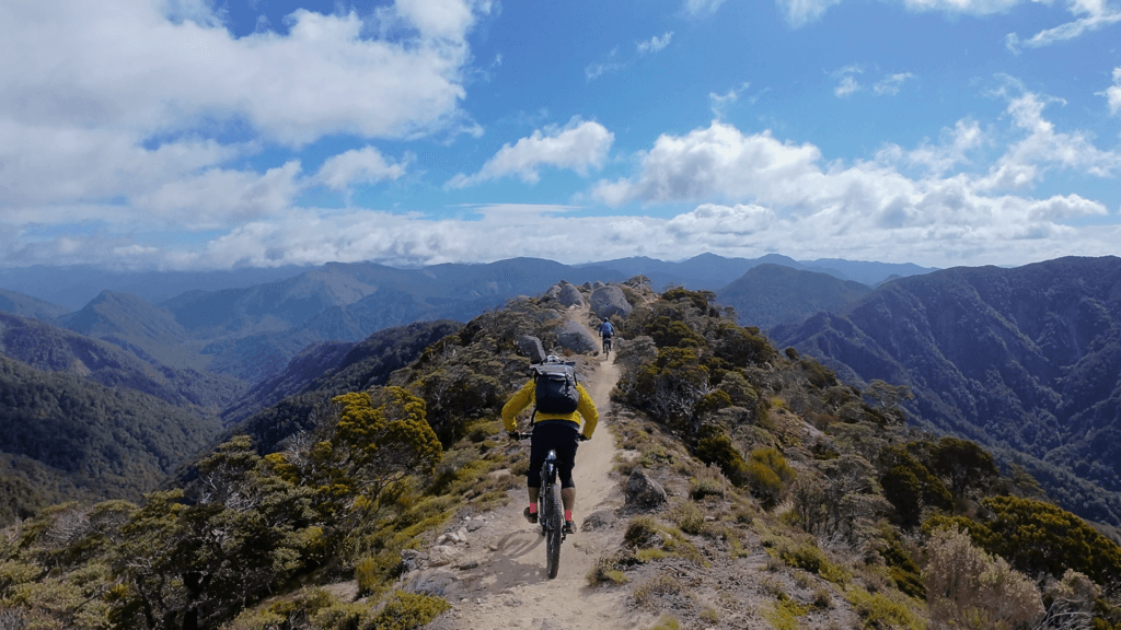
The Paparoa
Where: Starting at Smoke Ho Carpark (Blackball) and finishing in Punakaiki on the West Coast (can be ridden in either direction but starting in Smoke Ho gets the hardest riding out of the way early) Greymouth is the nearest major town.
What kind of riding: 56km (35 miles) of purpose built mountain bike trail traversing the rainforest then over alpine ridges with sea views.
Highlights: A hidden gem in the world MTB scene The Paparoa is equal to the Old Ghost Road in terms of epic views and riding but with the bonus of views across the Tasman Sea. Watching the mist rise from the sea and curl around the ridges is unforgettable.
How hard is it? There are big riding days and the trail can be rocky in places (~1,888 m/ 6,230ft of elevation gain over the whole track) and you would need to carry in food, sleeping bags and be self sufficient for medical and mechanical emergencies. The first 1000m of climbing is beautiful but consistent climbing to the first hut.
How technical is it? Grade 3-4 (Blue-Single Black) The trail is mostly well maintained with a few rock sections but no drops or jumps. Although riding along ridges there is rarely big drop offs or exposure and the track is quite wide 1m (3ft) in most places.
Things to know: Huts book out fast for the prime summer months December to March. There is little to no cell reception for most of the trail so you need to be able to fix mechanical issues and we suggest renting a Personal Locator Beacon. E-bikes are not allowed.
Do we guide it? Yes, although we don’t have it on our set itineraries we can add it into custom tours (no E-bikes allowed on this trail though) It is possible to self-guide with a vehicle transfer to get your car brought round to Punakaiki. Riders must be confident in their bike mechanical/ First Aid skills.
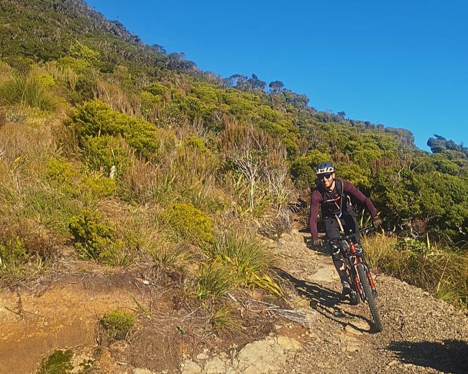
The Heaphy
Where: Kohaihai just above Karamea from the West and Brown Hut near Golden Bay on the Eastern End. This trail can be ridden from either end or there and back. These are both remote locations on the north-west of the South Island.
What kind of riding: 78.4 km (48.7 miles) one-way of mixed use trail. Though not designed for mountain biking the trail winds around the plateau in a very pleasing manner. The views are spectacular with large open skies across the tops.
Highlights: Extremely diverse landscapes from native beech forest on the eastern side to epic Avatar-like rainforest on the west with giant towering Totara trees. Throw in some incredible alpine plateau and carnivorous snails (no, I’m not joking) and this trail is like no other in the whole world.
How hard is it? The trail highpoint is at 900m and both sides start near sea level. Some of the climbs can be loose gravel and have deep drainage ditches that run over the track. Also you would need to carry in food, sleeping bags and be self sufficient for medical and mechanical emergencies. There are very nice huts along the way but they don’t have as nice facilities as the Old Ghost Road.
How technical is it? Grade 4 (Blue-Single Black) The trail is mostly well maintained with a few rocky sections but no drops or jumps. It can be prone to washouts particularly on the West Coast side.
Things to know: The trail is only open to mountain biking outside of the summer months. The Mountain Biking season runs May 1 to November 30 each year but walkers will still be using the trail. Most ride the trail over 2 to 3 days for mountain biking (4 to 6 days for walking). There is little to no cell reception for most of the trail so you need to be able to fix mechanical issues and we suggest renting a Personal Locator Beacon. E-bikes are not allowed. Also driving from one end to the other is a very long drive. Local providers like Golden Bay Air offer specialized bike transport, gear storage, and return flights or shuttles. Also no E-bikes allowed on this trail.
Do we guide it? Not currently as the season is a little tricky for us starting our other tours. It is possible to do self-guided with flights or shuttles though. Another option would be to ride in and out the same way.
The Craigieburns
Where: This classic mountain bike zone is often used for the NZ Enduro and is only 1.45 hours from Christchurch. This trail network has multiple entry points but the most common is from Mistletoe Flat or Texas Flat Carpark. (Texas Flat Carpark can have a rough road going to it and a vehicle with higher clearance is recommended.)
What kind of riding: 111km (69 miles) of hand built, rooty goodness. Epic technical riding with amazing views and the occasional scree traverse for those looking for a real backcountry flavour.
Highlights: Feeling completely remote in less than 2 hours drive of Christchurch. Savour the tranquility then prepare for root filled technical riding that is graded to suit everyone from Blue to Double Black runs. Finish the day with the Hogsback Traverse into Castle Hill Village.
How hard is it? All of the trails are accessed by pedalling and you can choose your own adventure. To truly experience most of the highlight trails expect to ride around 1000m (3000ft) of elevation gain.
How technical is it? Grade 3-5 (Blue-Double Black) A nice mix of grade but being comfortable riding blue trails with the occasional black will have you enjoying the area the most. For people looking for harder trails there are options for Black and Double Black descents too.
Things to know: This area is surprisingly remote and doesn’t have the best cell phone reception. Riders need to be self-sufficient mechanically and for medical events. This is real alpine riding conditions. October through April (late spring to autumn) is prime riding. The trails close in winter due to snow, ice, and serious alpine avalanche hazards. After frost do not ride the trails as the freeze- thaw cycle will damage the trails.
Do we guide it? Yes, it is part of our 7 Day Backcountry Mountain Bike Tour and our 7 Day Backcountry E-MTB Tour. It’s an absolute highlight and we can tailor the trail choice to give you the best riding on the day. It can be self guided if you park at the carparks and go from there or take two cars and park one at Castle Hill Village and one at the Mistletoe Flat Carpark.
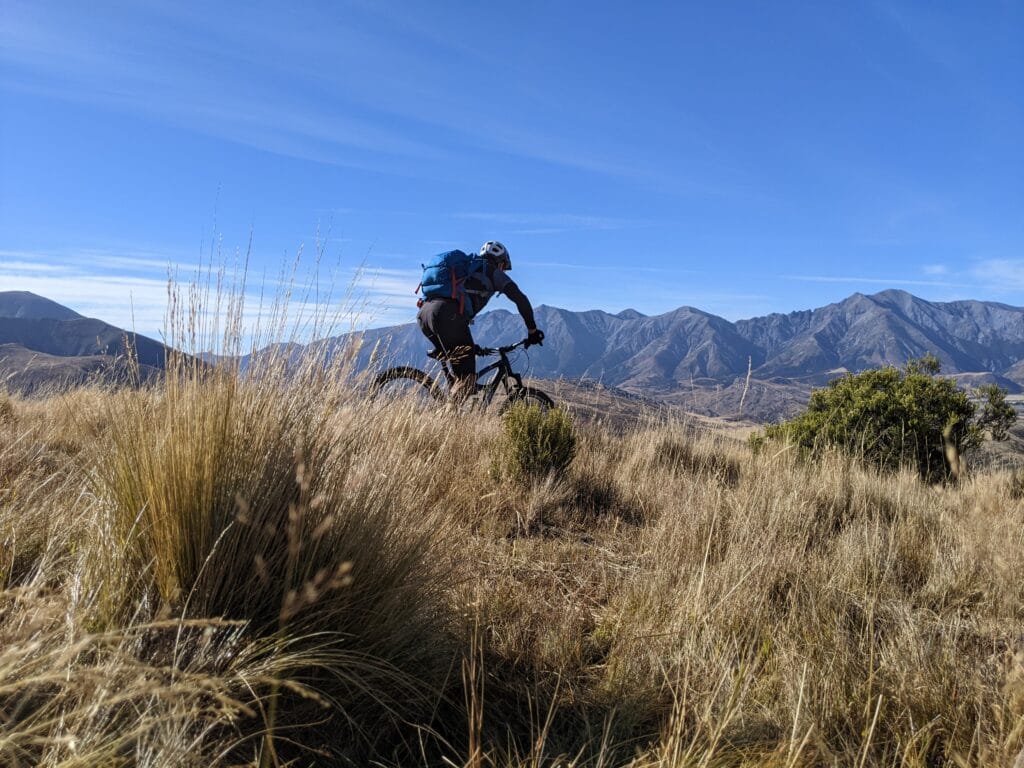
The St James
Where: A hidden gem and one of the lesser known Great Rides of New Zealand. It is near Hanmer Springs about 2.5 – 3 hours from Christchurch. Best ridden starting from the Maling Pass entrance down to the St James Homestead for more downhill riding and favorable prevailing winds.
What kind of riding: 59km (37miles) of backcountry riding through an old high country station with a mix of gravel roads, technical single track and multiple stream crossings.
Highlights: You won’t see another soul as you earn every stunning view of this trail. Great riding, natural hot pools, alpine lakes and wild horses. This trail has scenes unique even to New Zealand, I think it is totally underrated.
How hard is it? This trail can be difficult in places, it might even have a few sections of hike a bike and with multiple stream crossings, this is a real backcountry adventure. The highest point of the trail is at 1,308 meters (4000ft roughly)
How technical is it? Graded 3-4 (Blue-Black) with tight singletrack, scree trails and multiple river crossings. This trail is for experienced mountain bikers who enjoy a challenge.
Things to know: This area is remote and has poor cell phone reception. Riders need to be self-sufficient mechanically and for medical events, there is also very limited vehicle access. This is real alpine riding conditions. The best riding is November to April but check the weather for recent storms or snow as this can make the rivers impassable. Shuttles can be arranged from Hanmer Springs.
Do we guide it? Yes it can be added to custom trips and watch this space for our new itineraries which will cover this trail! Self-guided riders can get shuttles from Hanmer Springs but only at specific time of the year. Check with local providers too for trail conditions.
The Coronet Loop
Where: Starting and finishing in Arrowtown just outside of the riding hub of Queenstown. As a loop it can be ridden either direction but I recommend riding clockwise from Arrowtown and finishing with the river crossings.
What kind of riding: 50km (31 miles) of epic backcountry riding and singletrack. A really nice mix of purpose built bike trails and old 4×4 tracks before finishing on an old gravel road left over from the gold mining days.
Highlights: See a side of Queenstown Lakes that no one gets to see. As well as riding some of the best trails in the area. The trail down into Skippers Canyon is awesome and the views are spectacular. Checking out the goldmining town of Macetown on your way adds some historic significance and the river crossings add to the adventure.
How hard is it? Over 1,500 meters (5000ft) of elevation gain across the whole loop. Some of the climbs can be quite steep in sections but overall is very doable for a fit confident mountain bike rider in a day. Be prepared for the ride to take longer than expected though with heads winds and possible mechanicals.
How technical is it? Graded 3-4 (Blue-Black) with technical singletracks climbs and descents. There are also river crossings at the end which can be quite high depending on water levels and the time of year (Spring run off)
Things to know: Again this is remote backcountry riding. Even being so close to Queenstown cell phone reception is patchy and you must be totally self reliant. There is no vehicle access when on the backside of Coronet Peak. Open October to May but weather conditions vary and with recent snow or frost the trail should not be ridden.
Do we guide it? Not at the moment but we would love to get this on one of our longer South Island trips in the future. This can be self-guided quite easily starting in Arrowtown for riders who are comfortable with remote settings and backcountry travel.
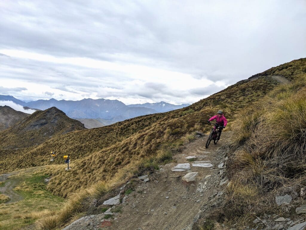
The Timber Trail
Where: One of the best trails in the North Island. It starts in Pureora Forest Park, running between Pureora (North) and Ongarue (South). Pureora is about 1 hour drive from Taupo and the trail can be ridden either direction but most ride north to south.
What kind of riding: 85km (52 miles) of purpose built cycle trail. Wide trails that wind through the forest. Some steady climbing up to the high point but not too technically difficult.
Highlights: Amazing forest riding including native bush, second growth forest and cloud rainforest. The descent from the high point is endless turns through an epic forest that is alive with bird song. There are 26 bridges spanning huge ravines that will take your breath away.
How hard is it? The trail climbs 1200m (3600ft) over the whole trail and the highest point is 971m (about 3000ft) There is a lodge in the middle for people who would like to split the trail into 2 days.
How technical is it? Graded 3 (Blue) with some steep climbs. The track is wide but can be rutted out or rooty in places.
Things to know: This area is remote and has poor cell phone reception. Riders need to be self-sufficient mechanically and for medical events there is also very limited vehicle access. The track can be ridden almost year round but in the winter it is still affected by alpine weather conditions. Shuttles, luggage transfers, bike and e-bike hire are widely available through local operators.
Do we guide it? No, we generally stick to the South Island but this trail is too good to be left out of this list. This can be self-guided with the help of local companies. The easiest idea would be staying at the Timber Trail Lodge and getting the shuttles from there.
Guided vs Self-guided mountain bike trip
This is an interesting question which I will cover more in another blog (and I definitely have some biases here) .
Guided
The obvious pro of having a guide is having the logistics taken care of as far as vehicles, safety, food and accommodations. Also having a local knowing the conditions and what the best trails are for those conditions is vital to get the most out of your trip. We make it easy to ride the best mountain bike trails in New Zealand day after day. We also take care of any mechanicals and medical issues as we are fully prepared for emergencies. For more about how we guide check out our About Page.
Self-Guided
That being said, New Zealand has so many good trails you won’t be disappointed no matter where you ride. Also, with some good research and planning a lot of these trails are great for self-guided riders and you can make the trip anyway you want. You can spend as much or as little time at any given location. Also Kiwis are very friendly so don’t be shy to ask locals where the best places to go are.
What do the mtb Trail Grades mean?
In New Zealand our trail grades are rated 1-6. This loosely follows the Green to Double Black format.You will see that some grades overlap slightly this allows for some nuance and just for the fact it is different systems. For a quick and dirty guide see below.
Green Trails: Grade 1& 2
Blue Trails: Grade 3
Black Trails: Grade 4&5
Double Black Trails: Grade 5&6
For a more detailed version see our post “New Zealand MTB Trail Grades Explained”
Frequently Asked Questions
What are the most challenging backcountry mountain bike trails in New Zealand?
The Old Ghost Road is the most challenging as far as technical riding and fitness requirements with the Paparoa being a close second.
What is the easiest backcountry mountain bike trail in New Zealand?
The easiest trail is theThe Timber trail and it is also very popular so feels less remote. It is still a true backcountry mountain bike trail but has a bigger margin of safety.
Can beginners ride the Old Ghost Road?
I would not recommend this. The trail is technical and requires a high level of fitness. But more importantly it is very remote and so if you get in over your head it is not an easy place to turn back or get out from.
Do you need a guide for the old ghost road?
The Old Ghost Road is just one trail so route finding shouldn’t be a problem. I would recommend a guide (I am very biased on that though) if you don’t have the mechanic, logistics and first aid skills mentioned below
What skills do you need for riding backcountry mountain bike trails?
Being confident that you have the tools and can fix most common mechanicals; snapped chain,punctures, damaged derailleur, snapped gear cable. Also have basic first aid skills and the equipment to use. Knowing how to read the weather and react accordingly.
What type of mountain bike is best for backcountry mountain bike trails in New Zealand?
A modern full suspension mountain bike with 120-150mm of suspension will cover most trails comfortably. Having a dropper post and hydraulic disk brakes are also vital as well as burly mountain bike tyres with a sturdy sidewall.
When is the best time to ride backcountry mountain bike trails?
The short answer is the spring through to autumn . November through until May. With these trails being backcountry trails though you need to be very aware of the weather and changing conditions. For a more detailed answer check out our blog When is the best time to go mountain biking in New Zealand?
Want to join our Mountain Bike Tour?
If any of these sounds like your kind of mountain bike trip then SIGN UP for more information and we can send you our brochure. We only run a few tours a year (when the riding is the best) so spaces are very limited.